
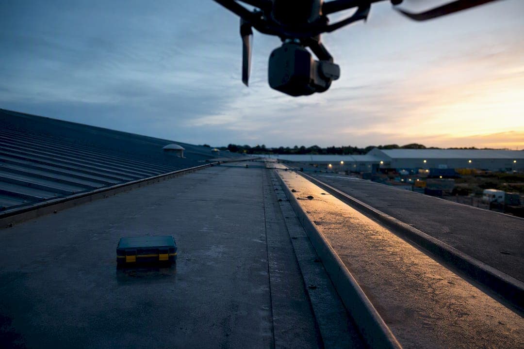
A drone roof inspection gives you fast, safer, measurement-grade evidence of roof condition without anyone climbing onto the roof. Most residential jobs take 10 to 20 minutes to capture, and you'll get annotated imagery, plus a measurement-ready report as your main deliverable. It suits post-storm checks, pre-purchase surveys, and insurance claims equally well. Ask any provider for a sample report before you book.
TL;DR:
- Drone roof inspections typically take 10 to 20 minutes for residential roofs, providing high-resolution images, thermal data, and measurement-ready reports.
- Thermal imaging is especially valuable on flat or older roofs to detect trapped moisture and hidden damage before visible signs appear.
- Costs vary based on added features like thermal scans, GCPs, and building complexity, but generally are lower than traditional scaffolding inspections.
- Providers should hold valid CAA permissions, carry insurance, and be able to show sample reports before booking, to ensure compliance and data security.
- Drone flights over private property are legal when operated by licensed pilots who follow UK airspace rules, with proper planning to address privacy and restricted zones.
Table of Contents
- What Does a Drone Roof Inspection Include?
- Why Drones Beat Ladders for Most UK Roofs
- How Does a Drone Roof Inspection Work?
- What Does a Drone Roof Inspection Cost in the UK?
- When Should You Book a Drone Roof Inspection?
- How Do You Choose a Drone Roof Inspection Provider?
- Are There Legal Restrictions on Drone Roof Inspections?
- Is My Data Safe During a Drone Roof Inspection?
- How J.H. Roofing Uses Drone Surveys in Practice
- Get a Drone Survey and a Straight Answer on Repairs
- Sources
- FAQ
What Does a Drone Roof Inspection Include?
A proper roof inspection using drones produces more than a folder of photos. Providers typically capture high-resolution stills, 4K video, and annotated images that flag cracked tiles, lifted flashing, or blocked gutters directly on the picture.
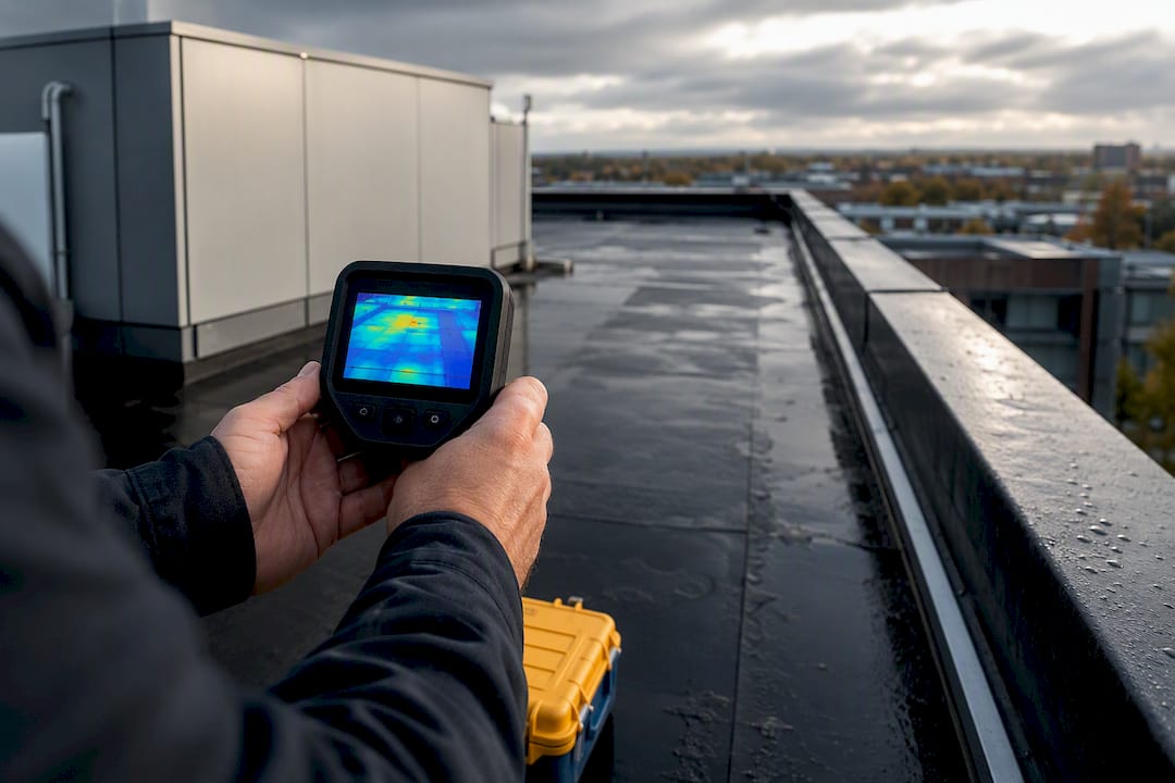
Many jobs also include thermal imaging, which reveals trapped moisture, wet insulation, and thermal anomalies that a visual pass alone would miss, according to Soprema's guidance on drone thermal surveys. That matters most on flat roofs, where standing water hides beneath a membrane for months before it shows up as a ceiling stain.
For larger or commercial roofs, expect mapping outputs too: orthomosaics (stitched aerial maps), 3D models, and measurement-ready files.
A typical deliverable package includes:
- High-resolution photos and 4K video of the full roof surface
- Annotated images marking specific defects with severity ratings
- GPS-tagged defect locations for repeat inspections
- Orthomosaic or 3D model files (often TIFF, OBJ, or LAZ format)
- A written report with recommended next steps
Ask what format the final report arrives in. A PDF with embedded photos suits most homeowners; commercial portfolio managers often want the raw orthomosaic files too.
Why Drones Beat Ladders for Most UK Roofs
Safety is the first reason. HSE guidance on working at height identifies falls from height as one of the leading causes of workplace fatalities in construction, which is exactly the risk a drone removes. Nobody needs a ladder, scaffold, or harness to get eyes on a ridge tile forty feet up.
Speed is the second. A single flight typically captures more usable roof data in 10 to 20 minutes than a ladder crew gathers in hours, according to SkyeBrowse's breakdown of drone inspection workflows. That difference compounds fast across a commercial portfolio with a dozen buildings on the schedule.
The third advantage is documentation. An orthomosaic or 3D model isn't a one-time snapshot. You can revisit it months later, compare it against a fresh flight after a storm, and hand insurers a consistent, time-stamped record rather than a stack of loose photos.
Pro Tip: Request thermal imaging alongside your standard visual pass if your roof is flat or over 10 years old. Trapped moisture rarely shows visible signs until the damage has already spread.
How Does a Drone Roof Inspection Work?
The process follows a predictable sequence, and knowing it helps you plan around it.
- Pre-flight briefing. The operator checks weather, confirms access, and reviews any site-specific permissions, particularly near flight-restricted zones or built-up areas.
- Capture. For residential roofs, a quick orbital flight pattern usually covers the whole structure in under 20 minutes. Commercial roofs with multiple sections or complex geometry can take an hour or more, especially if a photo-grid mission with 60 to 80% image overlap is needed for survey-grade accuracy.
- Processing. Video captures get uploaded and reviewed directly. Photo missions go through photogrammetry software that stitches overlapping images into an orthomosaic or 3D model, following the standard capture, process, deliver workflow SkyeBrowse describes. Thermal footage needs separate calibration and analysis.
- Delivery. Most residential reports land in your inbox within a few days as an annotated PDF. Commercial jobs requiring orthomosaic TIFFs, OBJ 3D files, or LAZ point clouds may take a little longer to process and package.
Weather rescheduling is common. Rain and strong wind push a flight back, and thermal passes specifically need stable ambient temperature to produce reliable readings.
What Does a Drone Roof Inspection Cost in the UK?
Pricing depends heavily on what you're asking for. A basic visual drone survey on an average UK residential roof typically sits at the lower end of the market, while adding thermal imaging or measurement-grade outputs pushes the price up.
Commercial and portfolio work is priced differently, usually scaled to roof size, building height, and how many separate structures are involved. A single-storey warehouse roof costs less to survey than a multi-building estate with awkward access points.
Several factors push a quote higher:
- PE-certified or surveyor-signed reports, which some insurers require for larger claims
- Ground control points (GCPs) or RTK positioning for sub-inch measurement accuracy, as DJI's enterprise inspection guidance explains
- Multiple buildings or roofs with difficult, obstructed access
- Thermal imaging as an add-on rather than standard inclusion
Weighed against the alternative, the value case is straightforward. Scaffolding for a full roof survey alone can run into hundreds of pounds before anyone even starts inspecting, and a faster, evidence-rich drone report can shorten the time an insurance claim spends sitting in someone's queue.
When Should You Book a Drone Roof Inspection?
Timing changes what you get out of the survey. A few scenarios call for it more urgently than others.
- After a storm. Fast, dated evidence of damage strengthens an insurance claim before debris gets cleared or weather does more harm.
- Before buying or letting a property. A survey catches defects that would otherwise surface only after you've signed.
- On a maintenance schedule. Commercial portfolios benefit from regular flights that build a comparable history over time.
- Ahead of insurance renewal. A current report can support your position on premiums or existing claims.
If you're weighing this against a general upkeep routine, our end-of-summer roof maintenance guide covers the seasonal checks that pair well with an aerial survey.
How Do You Choose a Drone Roof Inspection Provider?
Not every operator delivers the same standard of work, so a short checklist saves you from a disappointing report.
- Confirm the pilot holds valid CAA permissions and check they carry adequate public liability insurance.
- Ask which thermal sensor they use (FLIR or equivalent) and what accuracy tier their measurement outputs fall into.
- Request a sample report before booking, and confirm the file formats, GPS tagging, and expected turnaround.
- Clarify their policy on rescheduling for bad weather, and ask how they handle privacy around neighboring properties during flight.
Pro Tip: A provider who hesitates to show you a sample report or explain their insurance cover is a red flag worth taking seriously. A confident provider will have both ready before you even ask.
Are There Legal Restrictions on Drone Roof Inspections?
Drone flights over private property in the UK sit under Civil Aviation Authority rules, and any commercial operator flying for hire needs an Operational Authorisation from the CAA rather than the basic recreational registration a hobbyist uses. That authorization confirms the pilot has passed the required competency assessment and understands airspace restrictions.
Flying over someone else's property isn't automatically trespass in the way walking onto their land would be, but low-altitude flights that intrude on privacy or cause a nuisance can still create legal exposure for the operator. A competent commercial pilot plans flight paths that stay within reasonable height and avoid lingering directly over neighboring gardens.
Restricted airspace matters more in parts of Kent than many property owners realize, particularly near airports or other controlled zones. A properly licensed operator checks this before every flight rather than assuming open sky means clear sky.
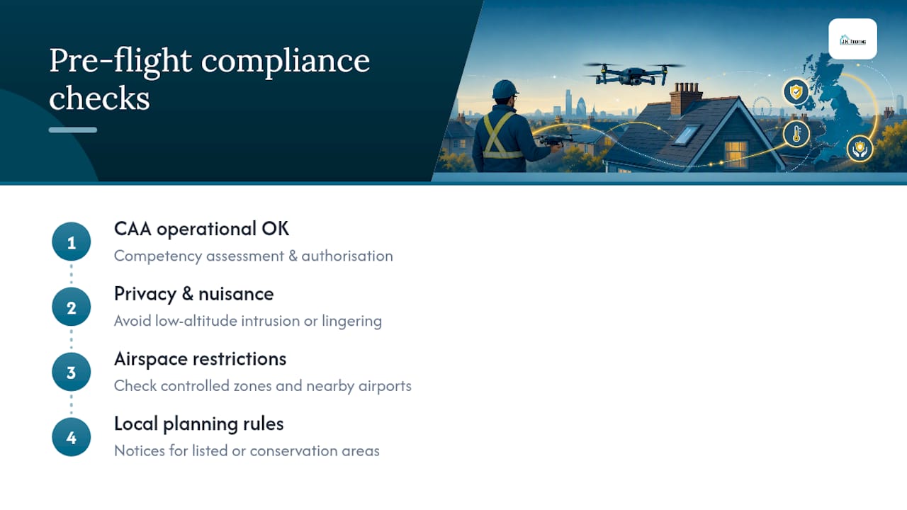
Local council rules occasionally add extra layers, especially for listed buildings or conservation areas, where any exterior work, including a survey flight capturing detailed imagery, might need advance notice. None of this should discourage you from booking an inspection. It simply means the provider handling the flight carries the compliance burden, and you're entitled to ask them to confirm it before the drone leaves the ground.
Is My Data Safe During a Drone Roof Inspection?
A drone flight over your property generates a lot of visual data, and where that data goes afterward is a fair question to ask before you book. Reputable providers store your imagery, thermal scans, and report files securely, and they should be able to tell you plainly how long they retain that data and who can access it.
Because a drone captures a wide field of view, footage sometimes includes glimpses of neighboring gardens or windows incidentally. A professional operator crops or blurs anything outside the scope of your survey rather than handing over unedited raw footage that captures more than your roof.
Ask directly whether your images will be used for marketing or shared with third parties without your consent. Most established providers will only use identifiable property imagery with your permission, and a clear answer to this question tells you a lot about how seriously they take their obligations.
If you're commissioning a survey ahead of a property sale or insurance claim, confirm who legally owns the final files. In most cases, that's you, the paying customer, though it's worth having that in writing rather than assuming it.
How J.H. Roofing Uses Drone Surveys in Practice
As a family-owned roofing business working across Kent for over 10 years, J.H. Roofing treats drone data as a starting point, not the finish line. A survey helps us scope a job accurately, estimate material takeoffs, and prioritize which repairs need attention first. It doesn't replace a hands-on look. Once the imagery flags a problem area, our insured team verifies it on site and carries out the repair itself, backed by our 24-hour emergency response when the situation calls for it.
— Gabbi
Get a Drone Survey and a Straight Answer on Repairs
Some roofing companies offer drone roof surveys and can also provide repair quotes directly after the survey, avoiding the need to hire separate survey and repair contractors.
If you're weighing up a full replacement rather than a patch repair, our flat roof replacement case study shows how survey data shaped a real scope of work. For thermal-specific concerns like a suspected leak that visual imagery alone can't confirm, Red Eagle's non-invasive leak detection service is a specialist option worth knowing about too.
Before booking with any provider, always ask for proof of CAA pilot qualifications and a sample report. When you're ready, browse our roofing services across Kent or run your numbers through our roof quote calculator to get a free, no-obligation estimate on any repair work a survey uncovers.
Sources
- SkyeBrowse — Drone roof inspections: cost, process & software
- DJI Enterprise — Inspection: roof inspections
FAQ
Can I Use a Drone to Inspect My Own Roof in the UK?
Yes, for personal, non-commercial use on your own property, though you still need to follow CAA drone code rules on height and privacy. Hiring a licensed commercial operator is the safer route for anything insurance-related or technically demanding.
How Much Does a Drone Roof Inspection Cost in the UK?
Basic residential visual drone surveys generally cost less, while adding thermal imaging or measurement-grade reports with GCPs increases the price. Commercial and portfolio pricing typically depends on roof size, height, and site complexity.
How Much Does a Standard Roof Inspection Cost in the UK?
Traditional inspections requiring ladders or scaffolding usually cost more than comparable drone surveys when including access equipment, and they often take several hours compared to the relatively short duration of a drone flight.
Is a Drone Roof Survey Worth It?
For most property owners, yes. It removes fall risk entirely, produces a measurement-ready record insurers and surveyors accept, and often costs less than scaffolding-based alternatives, particularly when a claim or sale is on a deadline.